
Where to find old maps of the area. How to find a spot to cop without an old map

How to calculate delicious place to dig without maps of the 18th-20th centuries? This question is of interest to many lovers of instrumental search, and every year it becomes more and more difficult to answer it.
I live in the Nizhny Novgorod region, our regions are very rich in forests, however, in recent times they are mercilessly cut down. However, so far our area is quite wooded and any ungrown islands in the forest (glades) are always of interest. And if there is a lake or a stream nearby, then it is simply necessary to go and explore the place in my opinion.
So, first sign the former place of residence of people - glades in the forest. Perhaps they will be slightly overgrown young birches. These trees do well in soil rich in organic matter. An additional clue is the presence of a nearby reservoir. If it turned into a stream or disappeared altogether, then a snake from small thickets will be visible on the satellite image.
Second sign, marking the existence of the village, the presence of a nearby cemetery. On Yandex maps, in most cases, the cemetery marks remain. There cannot be a cemetery separately from the village, therefore, somewhere nearby you need to look for a tract. From ancient times, they tried to arrange the cemetery in such a way that a river or stream (any running water) would flow between it and the village. According to legend, the river separated the world of the living from the world of the dead. It was believed that the dead would not be able to cross the river to the living. The water artery was a natural talisman, protection against the penetration of everything otherworldly.

Third sign, this is a road leading into the forest or field from the site of the former village. In most cases, the old roads have survived to the present day, in any case, from satellite images, one can guess where they once passed. Plus, minus a few meters to the right, to the left. Such small displacements occur when the road is used in bad weather. People choose where it is dry and go around the abyss, and this is how a new roll is obtained. This road again can lead to a small clearing. It is likely that an unattractive-looking clearing will turn out to be a very curious tract.

Fourth sign(not 100%), it's almost linear tree planting. The trees themselves almost never grow in straight lines (rows). It means that they were planted like that, or once they cut down extra trees that interfere with something.

Fifth sign, it’s more correct to say - the way is to drive to the nearest residential village to the point of interest and try to get information from local residents. It is better to take some treats with you (gingerbread, sweets). Local grandmothers will gladly (not always of course) tell you what kind of village it was, and maybe even remember who lived there.
Sixth sign, you probably know everything. Arriving at the place to inspect it, suddenly there are remains of foundations, broken bricks, ceramics. I advise you to walk on all metals in a new place and dig all the signals for at least thirty minutes. This will help you a lot in your search. You can imagine for yourself what and where it was (there was a house here, there is a lot of iron here - apparently a fur yard).
Finally.
When the first four signs converge, then I assure you you need to move into place without hesitation. These methods have been tested by me personally and more than once. There are a lot of similar points, because not all farms and cuts were marked on the maps. So if you are not too lazy and sit over satellite images and modern maps for an hour or two, then using these tips can be found interesting place For search.
is not just a piece of art, but also a source of important historical information of considerable value. That is why many historians, local historians, treasure hunters and others are looking for rare old maps and are ready to buy them for more money. Demand creates supply: every day the number of Internet sites that give rights to download old cards for payment is growing.
Our site is not one of those. You can download all the old maps of provinces and districts of Russia presented on our website for free. All old maps can be downloaded either directly from the pages of our site or from the "People" service. Narod is a Yandex service for storing files.
The Russian Empire (other names: All-Russian Empire, Russian State or Russia) was proclaimed following the results of the Northern War (1700-1721) by the Russian Tsar Peter I the Great and lasted until the collapse of the monarchy in 1917.
The capital of the Russian Empire was first St. Petersburg from 1721 to 1728, then Moscow (1728-1730), and then again St. Petersburg (in 1914 the city was renamed Petrograd) in 1730-1917.
By the end of the 19th century, the Russian Empire occupied 1/6 of the land and extended to the Arctic Ocean in the north and the Black Sea in the south, to the Baltic Sea in the west and the Pacific Ocean in the east.
On our website you can download for free the following old maps of the Russian Empire:
- Atlas of Russia, 1745
- A new map of the Russian Empire, divided into governorships, 1786
- Atlas of the Russian Empire, 1792
- Atlas of the Russian Empire, consisting of 52 maps, 1796
- Pocket Postal Atlas of the Russian Empire, 1808
- Geographical Atlas of the Russian Empire, 1820-1827
- Atlas of the Russian Empire, 1843
- , 1871
- Maps of Russia from The Comprehensive Atlas & Geography of The World, 1882
- Maps of the Russian Empire from Reference Atlas of the World, 1887
- Maps of the Russian Empire from Harmsworth Atlas and Gazetteer, 1909
- Map of Communications of the Russian Empire, 1916
Free download old maps of the European part of Russia
European Russia is the most populated and most developed part of the country located in Europe. The natural borders of European Russia from Asiatic were the Ural Range, r. Ural, Caspian Sea and Caucasus Range.
On our site you can download the following old maps of the European part of Russia for free:
- General Land Survey Plans (PGM), 1766-1861
- , 1799
- Postal map of European Russia, 1871
- Military topographic map of the western part of the Russian Empire (three-verst).
- Schubert's map (Special map of the Western part of the Russian Empire), 1826-1840
- Strelbitsky Map (Special Map of European Russia).
- Marx's Large World Desktop Atlas (Map of European Russia), 1909
- Large scale map of Russia in Europe, 1918
Free download old maps of Asiatic Russia
Asian Russia is a part of the Russian Empire located on the Asian continent. According to the Encyclopedia of Brockhaus and Efron, Asian Russia includes Siberia, Central Asian possessions and the Caucasus region. The natural borders of Asian Russia from European Russia were the Ural Range, the river. Ural, Caspian Sea and Caucasus Range. Asian Russia occupied the entire northern part of Asia.
On our site you can download for free the following old maps of Asiatic Russia:
- General map of Western Siberia with the Kirghiz steppe, 1848
- Map of Asian Russia, 1868
- Postal map of Asian Russia, Siberia, 1871
- Map of Asiatic Russia with possessions adjacent to it, 1884
- Road map along the rivers of Western Siberia: Ture, Tobol, Irtysh, Ob and Tom, 1884
- Map of the lines of communication of Asiatic Russia, 1901
- Atlas of Asian Russia, 1914
Free download old maps of individual provinces and regions
Province, the highest unit of administrative division and local structure in Russia, which took shape in the 18th century. For the first time, the division of the Russian Empire into provinces was carried out in 1708-1715 by Tsar Peter I by decree on regional reform. In 1708, the country was divided into 8 provinces headed by governors, endowed with full judicial and administrative power. Later, Empress Catherine II carried out a public administration reform, during which Russia was divided into 50 provinces headed by governors.
By 1914, Russia was divided into 78 provinces, 21 regions and 2 independent districts, in which there were 931 cities, and the Russian Empire included the Baltic states, Little Russia, Belarus, part of Poland (the Kingdom of Poland), Bessarabia, the North Caucasus, from the 19th century, in addition, Finland (Grand Duchy of Finland), Transcaucasia, Kazakhstan, Central Asia, etc.
On our website you can download the following old maps of provinces and districts of the Russian Empire for free:
Download old maps of St. Petersburg province
- Topographic map of the environs of Saint Petersburg, 1831
- Topographic map of Saint Petersburg Governorate, 1834
- Topographic map of parts of St. Petersburg and Vyborg provinces, 1860
- Map of the Petrograd Governorate, 1916
Download old maps of the Moscow province:
- Topographic map of Moscow Governorate, 1860
- Map of the outskirts of Moscow, 1878
Download old maps of the Crimean peninsula:
I think there is no need to tell how important cards are in finding coins and treasures. The success of most events depends on their presence or absence. If in the old days a simple desire to get out into the fields was enough, now the situation has changed radically. All the more or less well-known tracts, and even those completely lost in the forests and steppes, turned out to be quite thoroughly cleaned for ancient finds.
To continue to add to your collection or simply to enjoy the cop, you have to show more and more remarkable abilities in the field of finding untrodden places. In this case, the most important role is played by the cards of bygone centuries.
Currently, many of them are available to anyone, but as the advertisement says, they are not all equally useful. Yes, this is true, most of them are only suitable for planning trips to broken places.
Below we will describe what cards are, reveal their features and characterize them in terms of usefulness in business.
General Land Survey Plan - PGM (1780-1830)
Topographic materials began to be actively created under Peter I, at which time a large number of geographical atlases of the empire saw the light. During the reign of Catherine II, these works were continued. They, like Peter's, also did not differ in particular accuracy, but, nevertheless, they nevertheless transmitted the necessary and necessary information.
It was under Catherine the Great that the process of mass land surveying began. Its essence was as follows - the entire territory of the country was divided into counties, which, in turn, consisted of the so-called dacha plans, which were nothing more than plots of owners (allots) with confirmed rights to them and established boundaries. All of them received numbers, for their decoding, an additional Economic note was later issued to the survey plans.
These publications can hardly be called maps, because. they are still far from accurate and are more like diagrams-drawings. But still, from them you can get a lot of useful information on the emergence or existence of a particular settlement in those days.
Maps of Mende (1849-1866)
The name of these, and subsequently many other maps, was given by the names of the people who made the greatest contribution to their development and creation. All of them relied on and had the basis of publications created under Catherine and Paul I, it was on these initiatives that the further development of the so necessary was carried out, in primarily military, modern maps.
The new realities of that time revealed the need to create more accurate and detailed maps than the existing Military Road 40-verst publications. Taking the PGM as a basis and conducting large-scale cartographic surveys, military topographers under the leadership of A.I. Mende set about creating new detailed editions.

In total, two varieties of them were released.:
- one-verst, scale 1 inch is equal to 1 verst or 1cm is equal to 420m
- two-verst, scale in 1 inch 2 versts or 1cm 840m.
Such detailed publications appeared in 8 provinces, although surveys of the area were carried out in 21 provinces for 17 years.
provinces
1 and 2 versts - Tver, Vladimir, Ryazan, Penza, Simbirsk and Tambov.
1 verst - Nizhny Novgorod and Penza.
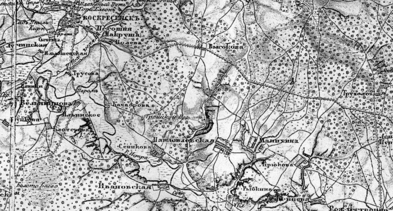
Schubert Maps (1860-1870)
Under the leadership of F.F. Schubert, who headed the Corps of Military Topographers in the early 19th century, a 10-verst map of the Western part of the Russian Empire on 60 sheets was created. But it, like the border 4 and 5 verst, was not very convenient, so soon work began on another.
A new map - three-versts was created first under the leadership of Major General P. A. Tuchkov (until 1851), and then work continued with the participation of Schubert. The period of its creation covers the second half of the 19th century, starting from 1846.
The scale is 3 versts in 1 inch or 1260 m in 1 cm.

The main part of the work was done before 1863 (435 sheets), further work was not suspended (in 1886 - 508 sheets), but basically it was reduced to supplementing and clarifying previous editions.
They turned out to contain cartographic material for all the provinces of the European part of the empire (with the exception of Moscow) and part of the adjacent territories (Ukraine, Belarus, Moldova and the Baltic states).
This map is distinguished by good detailing, showing the type of relief and the nature of the terrain: forest, swamp, rivers and streams, bridges, crossings, etc. All significant objects are placed on it, ranging from schemes of cities to villages with an indication of the number of courtyards, churches, mills, field and forest roads.
When using these materials, it is worth remembering two important features:
1) The accuracy of the designation of various objects has some error, for example, for the most significant it can be from 50 to 200m, for others - from 100 to 500m, and sometimes more.
2) When designating villages, it was customary to subdivide them by size using font, the names of large villages (20 or more households) were written in normal font, small villages and farms in italics.
Strelbitsky Maps
Starting from 1865, I.A. Strelbitsky, who at that time was part of the military topographic department at the General Staff, was instructed to update and supplement the Special Map of the European part of Russia. Under his leadership, work continued from 1865 to 1871. The publication consisted of 178 sheets, covered the provinces located in the center of the country, as well as parts of the adjacent western and southern territories.

Scale: 10 versts in 1 inch or 4200m in 1 cm.
In the future, it was she who served as the basis for the creation of such publications until the middle of the 20th century.
Red Army
These cards bear the abbreviated name of the Workers 'and Peasants' Red Army. These works have been published since the 1920s. Of course, for the most part they were based on publications issued before the revolution of 1917 (mostly layouts were used) and covered primarily the Western regions of the country. They were printed in the period from 1925 to 1941. The scale is from 250m to 5km.

They were produced with a number of additions and improvements, so they were actively used during the Second World War.
These maps are characterized by very clear detail and detail, they display all the roads, including the smallest ones, settlements indicating the number of yards, well, and other objects of interest from the point of view of military tactics. The vast majority of the sheets are made in color, but there are also black and white versions.
Their usefulness is certainly high, in view of the fact that many villages disappeared immediately or some time after the end of the war.
General Staff
From the name it is clear that they were produced for military needs, although they were also used by other services, for example, geodetic, topographic, geological, etc. These include editions released after the Second World War, which are again improved and modified previous maps. All of them have the same shape - the territory is divided into sheets, each of them, in turn, is divided into squares.
Initially, they were considered secret and it was almost impossible to get them in Soviet times. Now many (not all) of them are available for use.
Taking into account the fact that the General Staff has a much smaller error with respect to the coordinate grid, it makes sense to use them (in the absence of old ones) to search for tracts and plan travel routes.

The scale of such maps is the most diverse, ranging from 500 meters to 10 kilometers.
In addition to the above maps, of course, there are many other interesting ones. For example, in the 19th century, many provinces published their own - vicegerent maps, and many search engines also enjoyed great success with German (KDWR), Polish (WIG), which in fact are redrawn Russian layouts.
All maps can be used literally, so to speak, but if at least something can be found on the Soviet General Staff (at least the villages that existed after the war), then it is much more difficult to do this on versts, they require reference to the terrain. This is done using special programs, and then the already processed materials are loaded into the navigator.
Surveys of the area made tens and even hundreds of years ago are the history of our country. They will provide invaluable assistance not only to amateurs, but also to those who simply love to travel, study their land, its origin and development, and simply those who simply want to know the origin of their kind.
On the pages of this blog, I wrote quite a lot about the benefits of maps in our difficult but interesting business - treasure hunting. Thanks to the maps, we learn about the old villages, where they were located, how the street went, and when it approximately existed and disappeared.
According to the maps, we can even find those places where the digger's foot has not set foot. So, in the spring of last year, we got into an unbeaten repair. On PGM there was only a barely noticeable small square. But in fact, there actually turned out to be a settlement where the four of us dug up quite well.
Thanks to maps, we can make our discoveries. Indeed, without them it is not known where to go, unless of course you talk with the local population or identify tracts by poplars, which can be seen from afar.
In our heyday of the Internet, almost any map, old or not, is easy to find and start working with. In this article I will talk about some useful maps in detecting, in particular, those that I use myself.
satellite imagery
I'll start with the newest cards. Satellite images are now quite good quality. From them we can see the current state of the place we are interested in. Whether the field is overgrown with forest, whether houses are left in the village, find out the way to the detecting point. This is very detailed map, but it is difficult to overlook the change in heights on it. The relief looks flat. The scale of the pictures is detailed. By the way, if there is no detailed clear picture of the desired area from one service, you can find one from another. For example, if Google's terrain is blurry, then Yandex's is likely to be of excellent quality.
General Staff Cards
Also quite interesting maps. They are intended for the military, which is clear from the name. But they were also popular with topographers, surveyors, geologists, road builders, and others who work on the ground. All maps of the General Staff are similar: sheets of individual squares, divided into smaller squares. The scale is different. From 250 meters to 10 km in 1 cm. A couple of times I heard that there are also hundred meters, that is, 100 meters in 1 cm. At the same time, the maps of the General Staff have a very low error and can be used with great success on a GPS navigator for orientation and navigation, as well as finding places to dig and plot routes. All villages are clearly indicated and it is written how many inhabitants there were at the time the maps were created, the order of the location of streets, roads, mills is shown. I often use it myself, besides, the General Staff is loaded into the ozik on the phone.

Maps of the red army
Maps of the Workers 'and Peasants' Red Army. They are very similar to the General Staff, but they began to be created back in the 20s of the last century. Due to the lack of funds, people and opportunities, pre-revolutionary maps were taken as a basis. These cards have limited coverage. Namely, you can find maps of the Red Army only in the western part of our country. Not even the Kirov region. Although, somewhere there was a mention that there are topographic maps older than the General Staff of our regions. By the way, the inscription "Coordinate system of 1942" is often confused with the date of creation of this map. In fact, this is not the case, here we are only informed about the coordinate system. And the date of shooting and issue of the card is written in the upper right corner of the sheet. If the list of the General Staff was from 1942, then this is already a map of the Red Army. They, according to the information I have, were produced from 1925 to 1941. The scale is from 250 m to 5 km in 1 cm. Having examined this map, it attracted me with its detail and relative antiquity. Even the smallest settlements are indicated on it. The number of yards is indicated. Undoubtedly, a great map for a search engine! But it is a pity that it is not in our Vyatka region.

Schubert Map
With your permission, a brief background. At the beginning of the 19th century, F.F. Schubert headed the corps of military topographers and under him a 10-verst map of the Western parts of the Russian Empire was created on 60 sheets. But for some reason, it turned out to be inconvenient for practical use. I had to start working on a new one. It began to be created under the guidance of P. A. Tuchkov, but later Schubert took over the work on it. It covers the time period of almost the entire second half of the 19th century, starting from 1846. But the main work was done before 1863, when 435 sheets were made. Further work continued at a similar pace. In 1886, 508 sheets were drawn. Basically, they used the already compiled ten-verst line, only supplementing and clarifying it. Very good detail of objects. Literally everything that is needed is indicated: settlements, forests, rivers, roads, crossings, etc. There is even a character of the relief. Its scale is 3 versts in 1 inch or 1260 m in 1 cm. However, not all areas are drawn by Schubert. For example, Vyatka, alas, is not there.
Strelbitsky Map
In the middle of the 19th century, I. A. Strelbitsky was a member of the Military Topographic Department at the General Staff and he was instructed to update and supplement the Special Map of the European Part of Russia. Strelbitsky supervised this work from 1865 to 1871. The new map consisted of 178 sheets and covered the European part of the country and parts of the adjacent western and southern provinces. The scale is very inaccurate. There are 10 versts in 1 inch. And if translated in our manner, then 4200 m in 1 cm. In particular, this map was also used as the basis for creating maps of the Red Army. What to say about the map of Strelbitsky: a large error, only major roads and settlements are marked. Suitable, of course, as an overview map, but I do not use it.

Mende Map
Its author is A. I. Mende. From 1849 to 1866, he supervised the work on creating a map in the central provinces of the Russian Empire. When creating this map, 40 surveyors and 8 officers of the Corps of Military Topographers worked. Its scale is 420 m in 1 cm. Very interesting map, but covers far from the entire European part of Russia. It's a pity ... This is a boundary map with decent detail. Very similar to PGM.

PGM or General Survey Plan
The oldest of the maps presented here and, despite its age, is very accurate and detailed. The decree to create a general survey plan was given in 1796. Under Catherine the Great, mass land surveying began: the country's territory was divided into counties, and they were divided into dachas - plots of owners who had rights to these lands within certain boundaries. They were assigned numbers, and their decoding is given in the economic note, which was an addition to the plan for each province. The scale of the map is 1 or 2 versts in an inch, which is the usual 420 meters in 1 cm. When superimposed on modern map and when binding to satellites, you will encounter difficulty - the error is quite large. After all, this is not a map tied to coordinates, but just a plan. But enough detailed plan! From it you can get a lot of useful information for searching with a metal detector about the time the point appeared, its size at that time, the location of the street and houses, about roads and highways. Churches and church lands are marked, on which markets and fairs could be located, since these territories were not taxed. The map is very interesting and I use it. It is suitable as an overview map: look, think and go. I don't see the point in linking it. But to impose on modern satellite imagery still worth it! By the way, some sheets, due to their dilapidation, may not be well preserved and instead of places of interest you will see a hole.

Thus, we have just examined those cards that are mainly used by treasure hunters. There are also other cards, but about them sometime later.
Each map is good in its own way and brings certain benefits to the digger when planning places for digging and studying the history of his area. And you need to use the cards at the same time, mentally overlaying them on top of each other and comparing the terrain on the old and more new map. These cards are the history of our country.
Where can I download?
Yes, right here on this blog. I recently started uploading old maps. You can view and download them.
Related publications
-
 Can PS4 be flashed? We answer the question. Is it worth it to flash PS4. What are the pros and cons of playstation 4 firmware
Ladies and gentlemen, it's done! PS4 is hacked, and below I will give you all the information you need, from buying a PS4 to running the downloaded...
-
 Download Hacked Drive Ahead!
Drive Ahead Game! on Android - the most real gladiator battles in cars taking place in real time in a virtual arena....